Shelter Associates
The challenge and the organization
In India, more than one in six urban citizens live in poverty, often in slums. Many of the urban poor lack access to the most basic of sanitary resources: a toilet. As of 2015, 65 million people lived in India’s slums, a number that may grow to 100 million by 2020.
Improper sanitation causes health problems, including contaminated water and an increase in communicable diseases. It also poses personal safety concerns, particularly for women. Adolescent girls and women risk harassment or assault when walking alone to use community toilets, especially at night.
Shelter Associates is an Indian civil society organization founded in 1994 to ensure access to basic infrastructure and housing for the urban poor. The organization set out to solve India’s urban sanitation issues in 2013 with the launch of its One Home One Toilet initiative. Shelter Associates recognized that sanitation problems in Indian cities are compounded by a lack of even the most basic information about slums’ infrastructure, including maps of sewage and water lines.
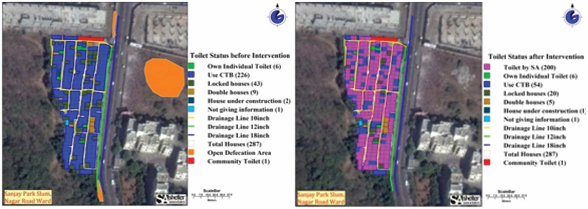 “
“Maps showing the location and status of household toilets before (left) and after (right) Shelter Associates’ One Home One Toilet project
”How they did it
One Home One Toilet uses Google Earth Pro and other geographic information systems (GIS) data to map slums’ infrastructure, showing which homes do not have individual toilets or access to communal ones. Shelter Associates conducts household surveys to gather information about a home’s access to essential services such as water, as well as demographic data. The group then uses satellite base maps from Google Earth to annotate every house on a map.
A new map is then created to display the slum’s existing infrastructure and access to various services, including toilets, running water and waste disposal, for individual households. The resulting maps show gaps in the slum infrastructure, which makes it easy for Shelter Associates staff to identify households that do not have in-home toilets, as well as areas of a slum that lack sewage and/or drainage lines. The organization uses maps to help with planning and logistics and to report on which homes ultimately have toilets installed, which families can request.
Impact
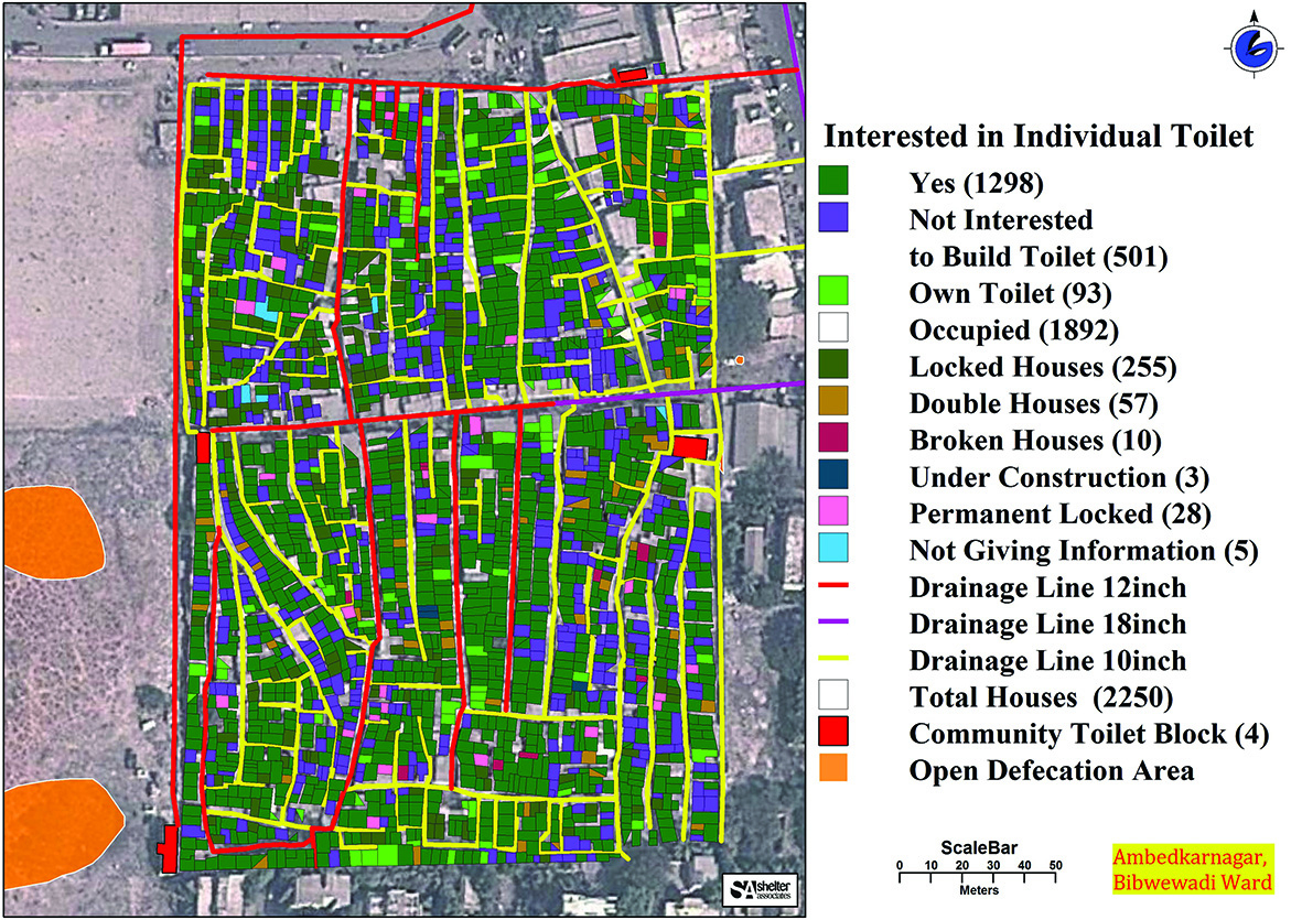 “
“An example of a map generated after household surveys, showing households with individual toilets and those that lack them
”In the past, policy makers, project managers, NGOs and beneficiaries often worked in silos,. However, thanks to the power of GIS and mapping, they are all working within the same framework, in touch with the same reality, because of the information displayed on maps.
”Pratima Joshi, executive director and founder, Shelter Associates
With Google Earth Pro, Shelter Associates has made life better for thousands of slum dwellers throughout five cities in the state of Maharashtra. Shelter Associates has mapped more than 200,000 households, helping 9,000 people improve their housing and more than 105,000 people get access to improved sanitation. Using information mapped by The One Home One Toilet project, sewage and drainage networks have been cleaned, and new pipes installed. Women and adolescent girls are not prey to harassment at night when visiting communal toilets, because they now have toilets at home.
“My ultimate dream for mapping and Shelter Associates is to give the most vulnerable in our cities a much better quality of life — and visualizing data using maps is an extremely powerful tool for doing this,” Joshi says.


