Nature Conservation
Mapping, monitoring, and measuring the dynamic changes occurring to our planet can help inform how we protect different living systems, and in turn, protect the planet as a whole.
The signs are all around us that Earth’s vital signs are in critical condition. In May 2019, a global assessment projected the extinction of one million species and demonstrated the interconnectedness between our planet’s life-sustaining resources. If we affect one part of our planet, then there’s a corresponding impact somewhere else. If human pressures continue to expand over the Earth, our own species’ survival is at risk.
Our Nature Conservation efforts align under the premise that nature needs enough space to thrive, whether in formally protected areas or well managed private areas. The areas that are protected need to be monitored to ensure they are effectively functioning as true protected areas. Everyone benefits from ecosystems remaining intact. Below is a collection of some of the projects within our Nature Conservation efforts.
As anthropologist Jane Goodall says, “Only if we understand can we care; only if we care will we act.” If there was ever such a moment for understanding to evolve into caring and acting, it’s now.
Wildlife Insights
Wildlife Insights is an effort with leading conservation organizations including Conservation International, Smithsonian Conservation Biology Institute, North Carolina Museum of Natural Sciences, Wildlife Conservation Society, WWF, Zoological Society of London, and Google Earth Outreach. Wildlife Insights is supported by the Gordon and Betty Moore Foundation and Lyda Hill Philanthropies.
The Wildlife Insights platform streamlines conservation monitoring by speeding up camera trap data analysis. Researchers who have camera trap data can upload them to the Google Cloud-based platform, where they can manage, identify and analyze their biodiversity data. Researchers can also run AI models over their data to eliminate images without animals and to identify species in images. Using Google’s open source TensorFlow framework, Google has trained AI models to filter blank images, or images without animals, and do species classification. Learn more about Wildlife Insights AI and try the AI models yourself in an interactive drag-and-drop demo.
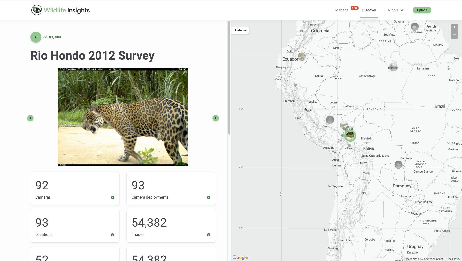
Watch a short film about the importance of camera traps to monitor wildlife in Colombia. Learn more at http://www.wildlifeinsights.org.
Featured Examples of Advancing Conservation Science with Google Earth Engine
Global Deal for Nature
The Global Deal for Nature is a science-based, time-bound plan to save the abundance and diversity of life on Earth. The paper contends that in order for the Paris Climate Agreement to succeed, we need an accompanying deal for protecting and restoring nature — thus, a Global Deal for Nature. Read more about how they used Google Earth Engine to calculate how people can protect 50% of the planet for nature.
An preceding paper, led by Dr. Eric Dinerstein, along with many conservation scientists, advocates for protecting half of the terrestrial realm, ecoregion-by-ecoregion. Using Dr. Matt Hansen’s forest loss data and UNEP’s World Database on Protected Areas, University of Minnesota’s Anup Joshi used Google Earth Engine to compute how much of the planet could be set aside for nature. The Google Earth Outreach team collaborated on visualizing the new Ecoregions2017©Resolve dataset, biomes and protected area status. Explore the map and download the data.
Map of Life
The Map of Life team has developed an an interactive map for conservators to view and analyze habitat ranges and to assess the security of individual species. Using Earth Engine to combine data from a variety of sources, Map of Life has refined their predictions for pinpointing the locations of at-risk species. Users can adjust the parameters (indicating, for instance, a species' preferred habitat), and Earth Engine updates the map on-the-fly, immediately showing the impact on the species range and the amount of protected habitat. Learn more.
Tiger Habitat Monitoring
A team led by University of Minnesota's Anup Joshi developed a satellite-based monitoring system to track changes and prevent loss to critical endangered wild tiger habitats. Using Google Earth Engine, forest loss data generated by Dr. Matt Hansen and Google, and other data available at Global Forest Watch, the team assessed the changes to all critical tiger habitats over a 14 year period. The assessment is the first to track all 76 areas prioritized for wild tiger conservation across 13 different countries. Their analysis found that the international goal to double the wild tiger population by 2022 is achievable with effective forest protection and management. Learn more.
There are many other examples of Google Earth Engine being put to use for advancing conservation science. Check out our YouTube channel for some that have been featured at our Geo for Good annual summits.
Street View Storytelling for Conservation
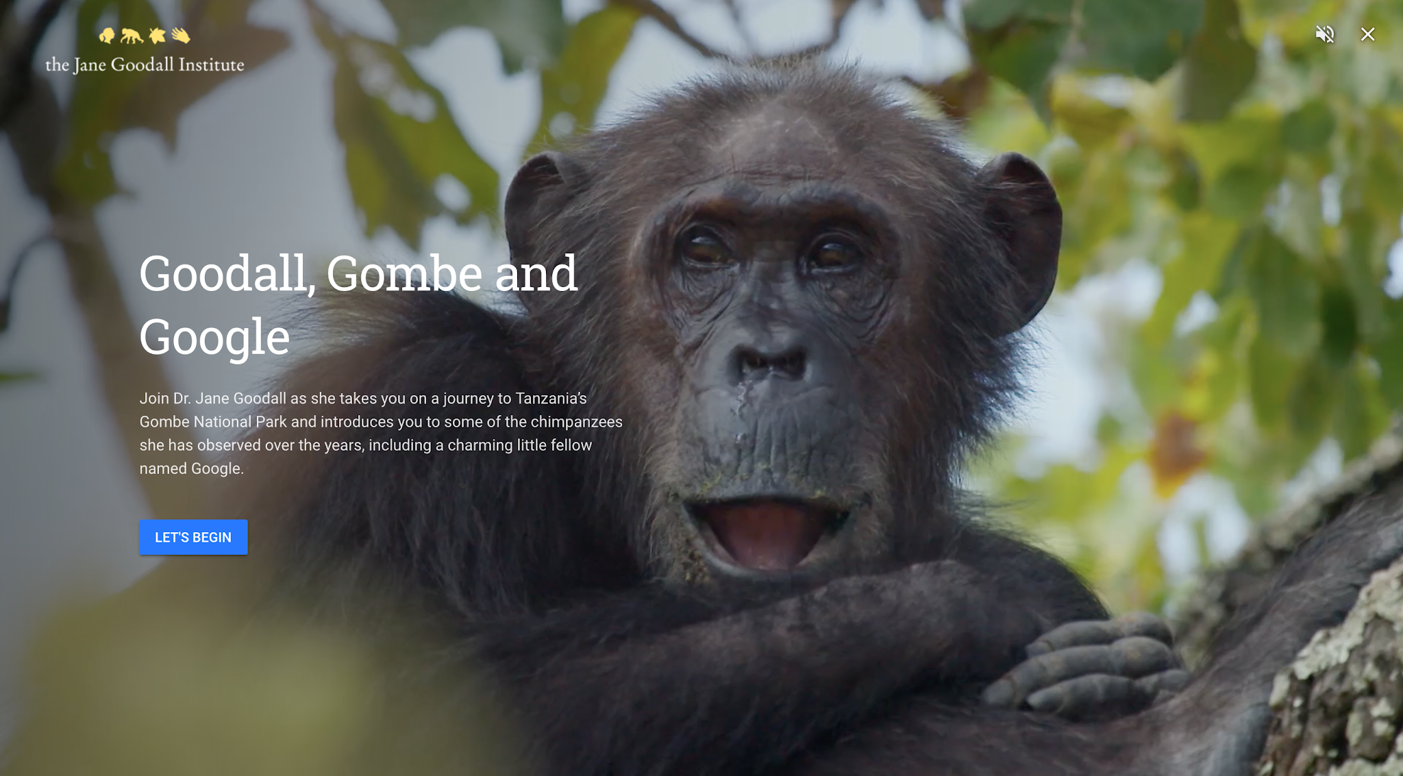
Go on safari with Save the Elephants and meet the wild elephants of Kenya in their natural habitat. Explore the Galapagos by foot and walk right by blue-footed boobies with the Charles Darwin Foundation. Visit Jane Goodall’s research cabin and meet the chimpanzees of Gombe National Park, as well as one young chimp she named Google, and learn how their work with communities and citizen science has resulted in more habitat for chimps. Experience these stories and more from partners like Wildscreen Arkive, WWF, and BBC Earth, in the Voyager feature of the new Google Earth.